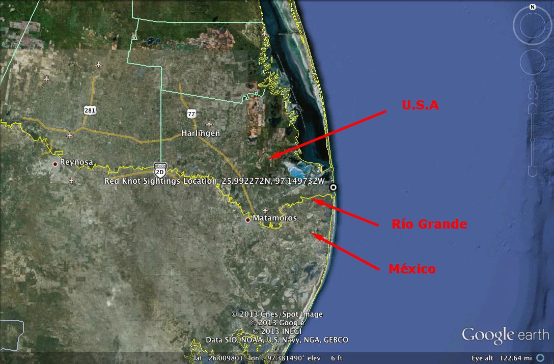
About 20 miles east of Brownsville, Tx / Matamoros, México, the Río Grande empties into the Gulf of Mexico.
The squiggly yellow line is the Río Grande:
One takes TX Highway 4 from Brownsville to Boca Chica State Park. The road ends at the Boca Chica Beach.
The road to the beach (upper yellow line) is shown: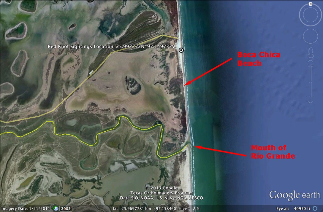
The beach seems to be used primarily by fishermen. To get to the mouth of the Río Grande, one has to drive 2.8 miles.
We did not get to Boca Chica until after 5:30 PM and weren't sure whether the tide was coming in or out and had read that deep sand was sometimes a problem and didn't know what the border situation might be. But we met a couple of fishermen on their way to the mouth who assured us that there was no problem, so we followed them there.
Mouth of Rio Grande: Gulf on left (east). México in center (south). Río Grande center right. US on right (north). The picnickers and lighthouse are in México:

The photo above is from 4 photos stitched together, with a resultant wide-angle distortion.
This photo gives a better perspective on the Río Grande mouth: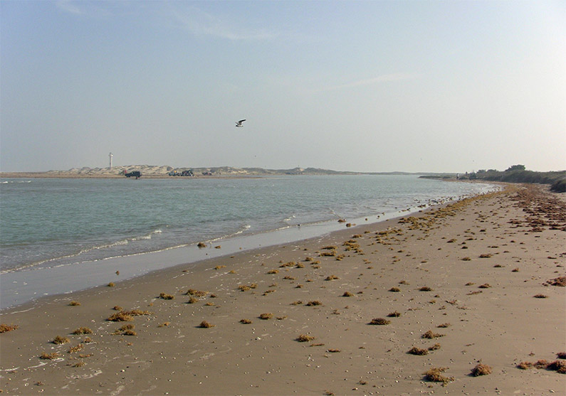
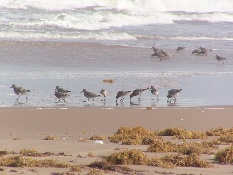
During the time on the Boca Chica beach, we observed numerous flocks of Red Knot, a Robin size sandpiper that breeds in the arctic in summer, but winters on more southern beaches in the US, Mexico, Central and South America.
Here is a range map for the Red Knot. The orange areas in the Arctic are the summer breeding areas. The blue along the coasts are the wintering areas.
So some of these individuals travel the full length of the western hemisphere land mass twice every year, once in the spring migration and once in the fall migration.
Red Knot (Calidris canutus)
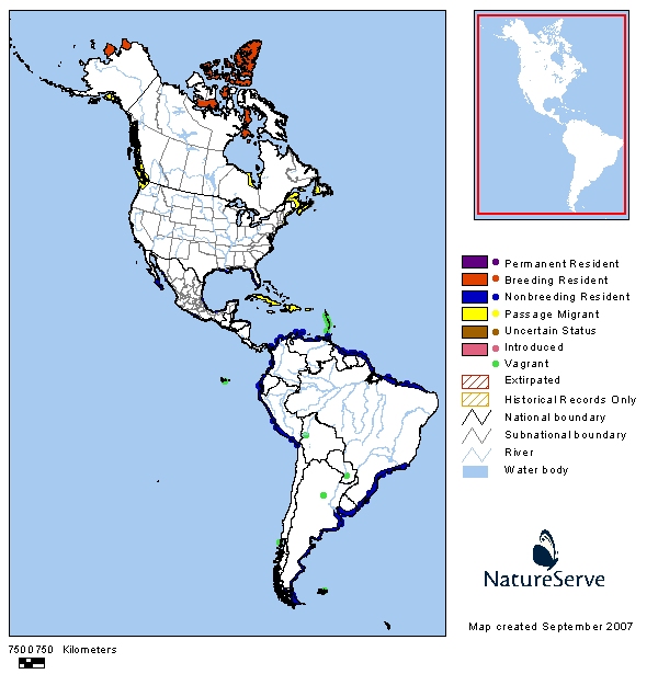
Range data provided by Infonatura/Natureserve. Ridgely, R. S., T. F. Alnutt, T. Brooks, D. K. McNicol, D. W. Mehlman, B. E. Young, and J. R. Zook. 2005 Digital Distribution Maps of the Birds of the Western Hemisphere, version 2.1 NatureServe, Arlington, Virginia, USA
We noticed that several had lime green flags on their left thighs. Using a spotting scope, I was able to read the code on one of the flags. When I processed my photos that evening, I was able to read another code.
Red Knots at Boca Chica. Note green flag on thigh of individual (2nd to left):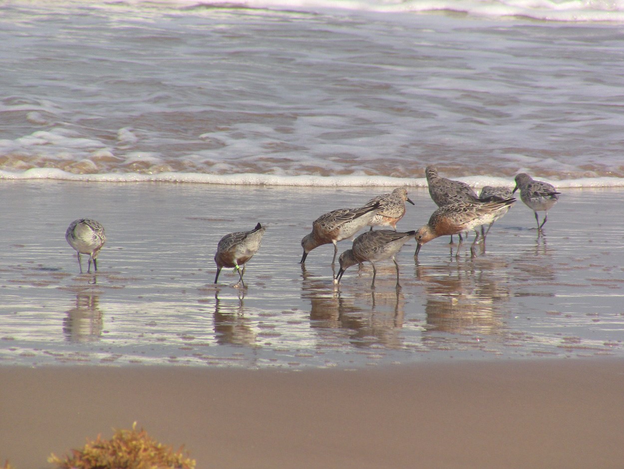
Close-up of banding flag: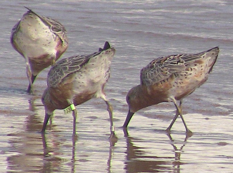
Banding of birds is a widely used technique for studying their movements.
I went online and did a search about reporting banding codes on Red Knots. I found a form for reporting my sightings and then I was able to see a report of the original banding and other re-sightings of the two individuals I reported. The report included detailed information on the location such as time of day, activity of the bird, human usage of the beach area.
Here are the capture (banding) and re-sighting records for this individual (7J3) pictured above: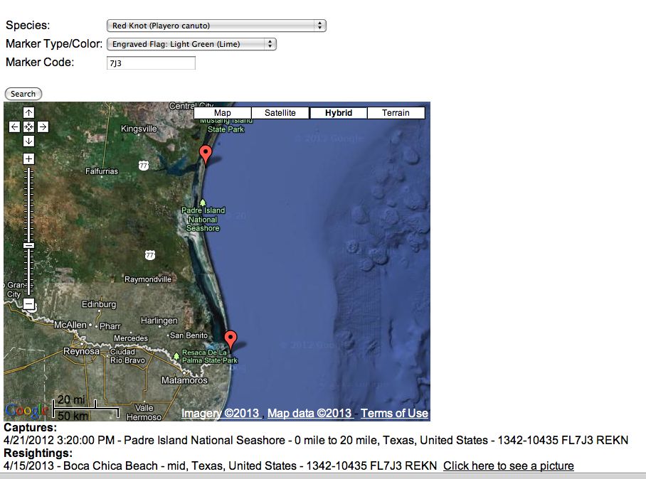
Here are the capture (banding) and re-sighting records for the other individual with the code 6L2. This is the code I read through my spotting scope. There was an additional metal band on this individual's right leg: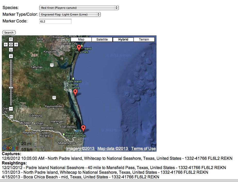
When I reported my sighting, I established an account with the banding organization, so I will be able to track these individuals over time. It turns out that there is an active sub-culture of birdwatchers who invest considerable time and energy into observing and photographing migrating flocks of Red Knots and other species for the express purpose of reporting banding codes.
Here is a link to another banding re-sighting you may find interesting. One of our traveling companions on the Texas trip, Jack Rothman, leads bird walks on City Island, The Bronx, New York City. In 2010, he was able to read banding numbers on a Barnacle Goose. A rare visitor to America, the bird turned out to have been banded in Scotland.
Read Jack's story on his website: CityIslandBirds.com
Questions? Comments?
Email: Robert Templeton at: rt@rioembudobirds.org